RBM Documentation Service

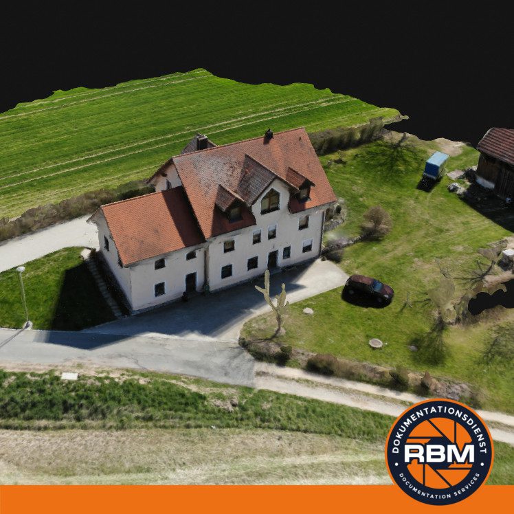
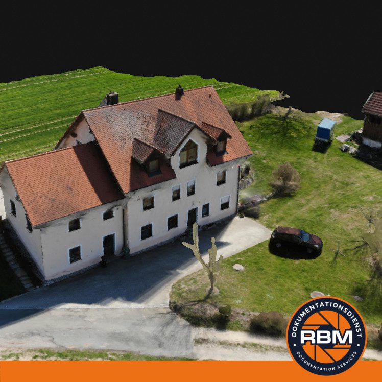
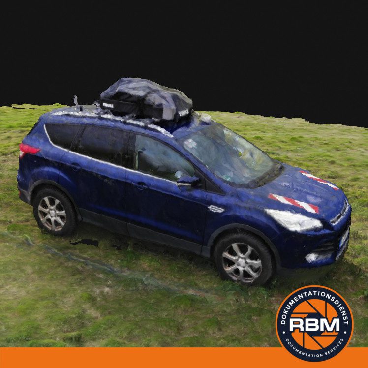
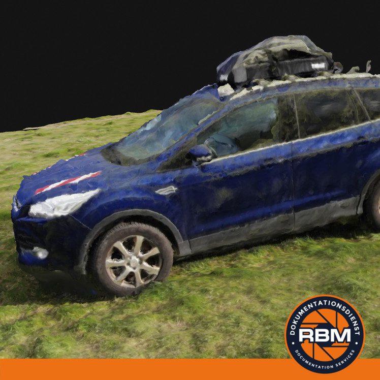
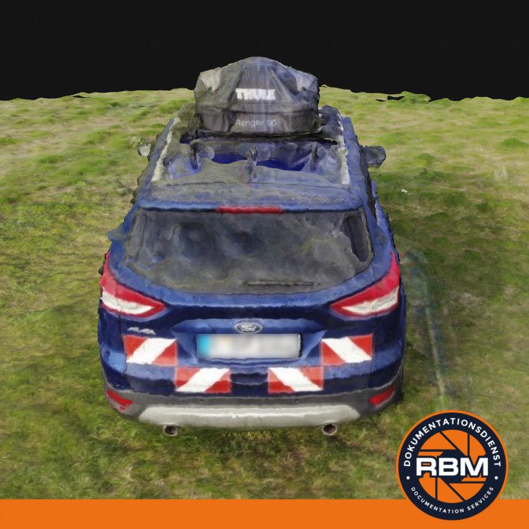
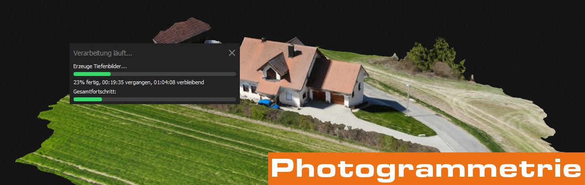
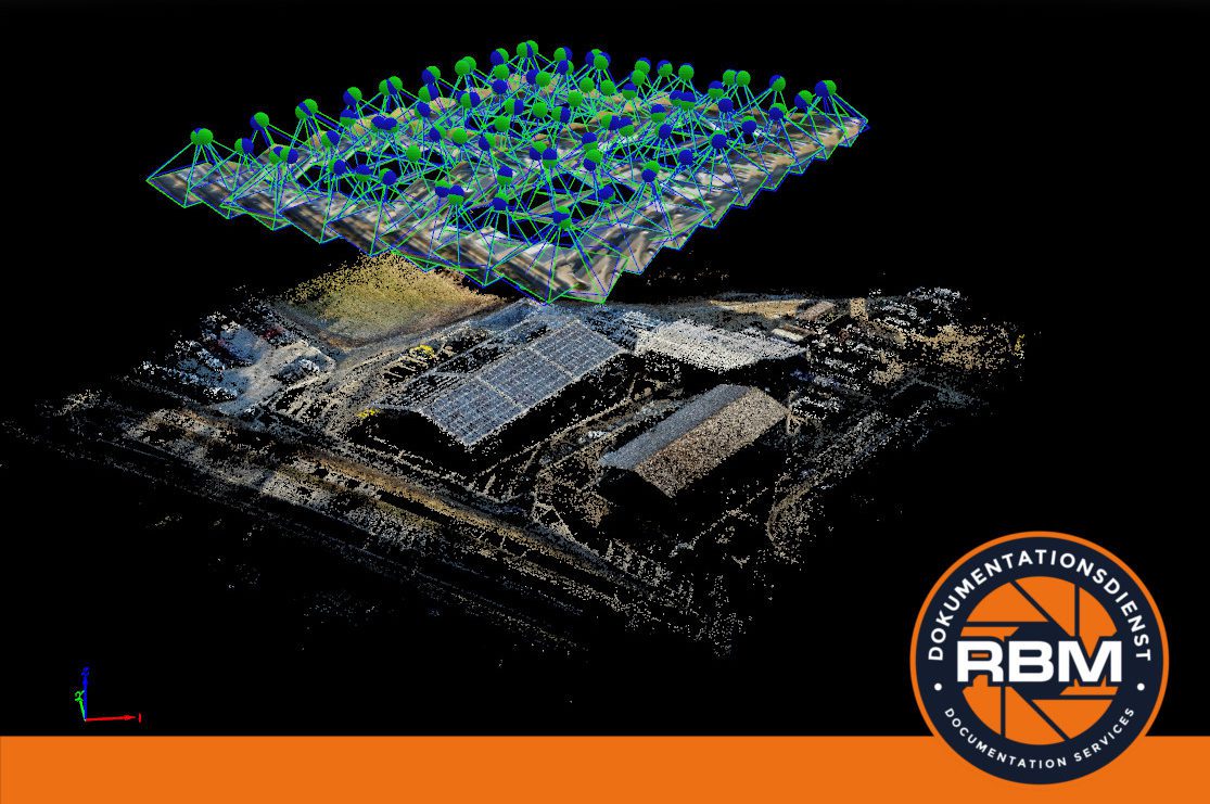
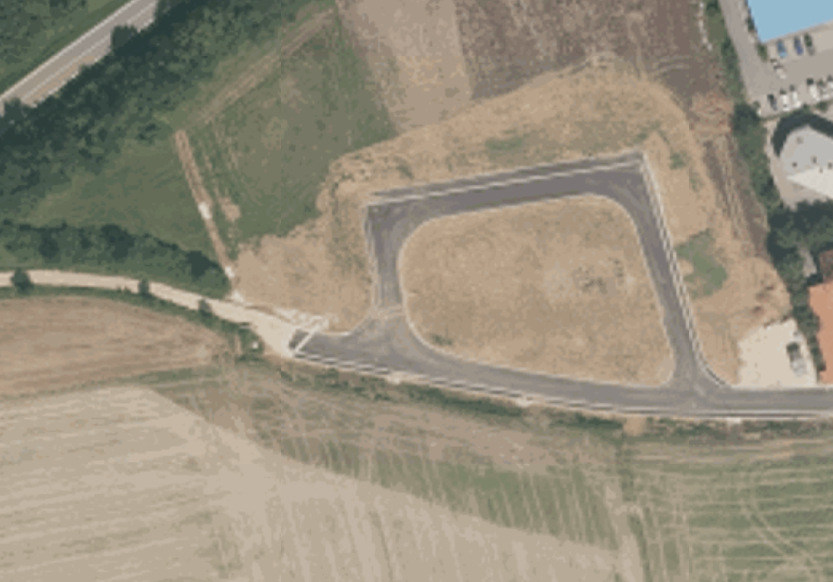
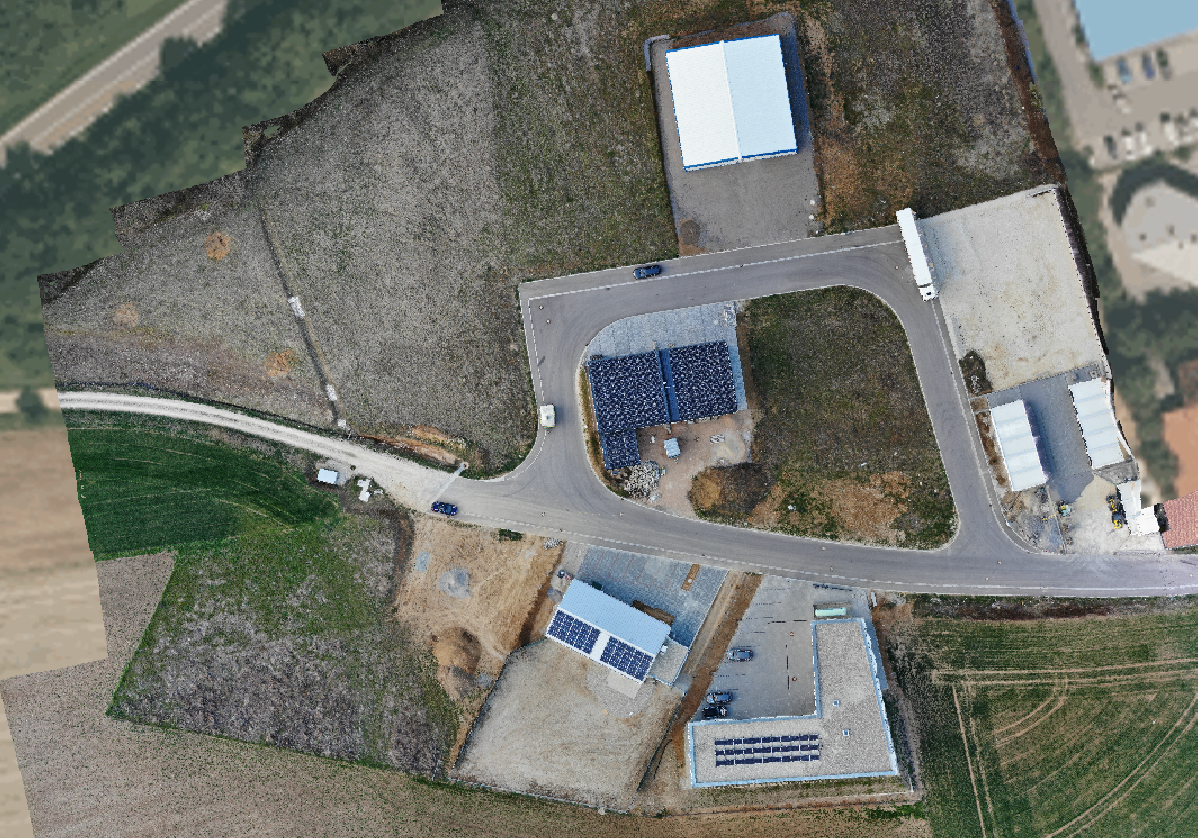
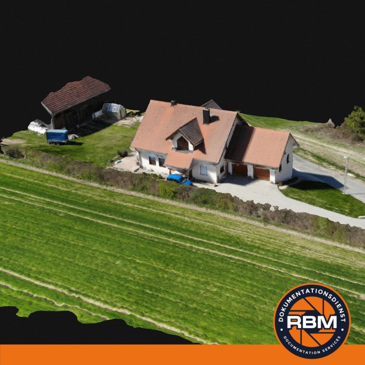
A drone can be used for other applications besides normal aerial photography. 2D aerial photographs are combined into an orthophoto using software and used for surveying purposes, for example. A point cloud can be created from many individual all-round photos of a building on the computer, and in the end a realistic 3D model can be created. Surveyors use this for accident reconstruction, for example.

Note: We are not engineers or surveyors and only provide you with the data that you can evaluate and work with using your GIS or CAD software.

2D Mapping - Orthophotos & Mapping

The RBM documentation service creates a georeferenced orthophoto of surfaces, buildings or facades from many individual aerial photographs. These are an important basis for decision-making for architects, urban and traffic planners, engineers or surveyors to plan investments in structural measures.

Example 1: An internet provider is planning to lay a new fibre optic network. By creating an orthophoto of the entire development area, he can calculate the required amount of fibre optic cable to the centimetre.

Example 2: An architect wants to assess a new building area on the computer. However, he only finds outdated maps with the usual map providers on the internet. We create up-to-date (depending on size) 2D maps.

RBM Documentation Service RBM Documentation Service

Digital surface/terrain model & volume calculations

In addition to classic 2D maps, we can also produce 3D maps by double-flighting the corresponding area. Using digital surface data, we can calculate not only the area dimensions, but also the necessary excavation of the masses to be moved; for example, the excavation of an excavation pit or bulk material in a gravel pit.

We provide you with the digital data in many common file formats for independent further processing:

Data types:

- Digital Terrain Model (DTM)
- Digital surface model (DOM)
- Digital and rectified ortho aerial photograph (DOP)
- Triangular meshing (triangulation)
- Coloured 3D point cloud

3D Scanning - Building & Vehicle Models

We fly around objects and buildings 360° and take many photos. From these photos, realistic 3D models are then calculated on the PC using software.

This means that exact measurements can be taken on the models on the computer, for example to determine the roof area of a house and thus calculate the required number of tiles for a new roofing. Or to measure traces on an accident car afterwards.

Cookie Consent Banner by Real Cookie Banner