
Building documentation

Wir dokumentieren Ihr Bauprojekt von der Grundsteinlegung bis zur Fertigstellung. Und zwar so, sodass Sie die Bilder zur Qualitäts- oder Beweissicherung einsetzen und jeden Arbeitsschritt nachvollziehen können.
Damage documentation
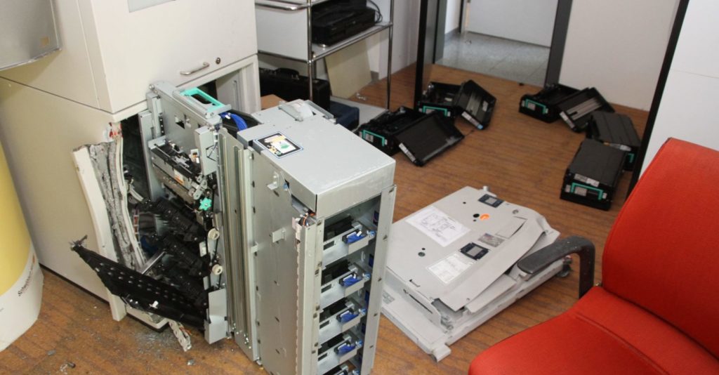
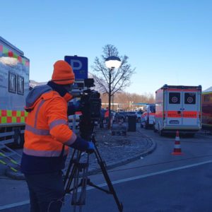
We document damage after a storm, fire, accident or burglary in high-resolution images and with all details. For private individuals, insurance companies or authorities.
Aerial Photography Service

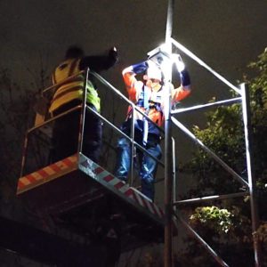
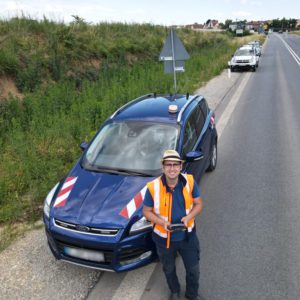
Do you need the latest aerial shots quickly? We are ready with our multicopter to deliver the aerial shots you need. Day and night at an altitude of up to 120 metres.
Time-lapse systems
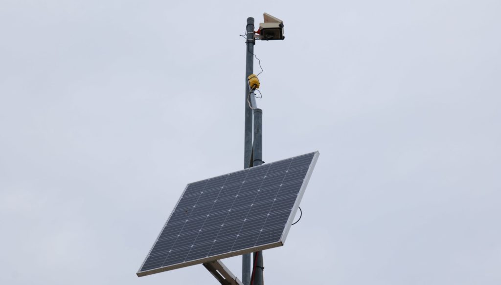
Our time-lapse systems deliver photos at regular intervals, which are then assembled into a video film, at a fixed location and completely independent of 230V mains power.
Foto- & Videodokumentation

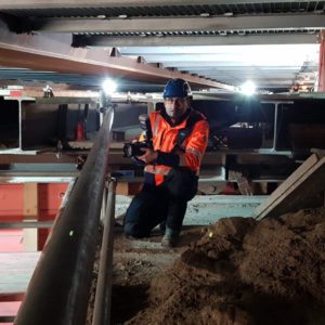
Wir dokumentieren nicht nur Baustellen, sondern erstellen Fotodokumentationen und Videodokumentationen in vielen Bereichen – vor allem mit technischem Hintergrund.
2D / 3D photogrammetry

2D and 3D aerial photographs are compiled into centimetre-precise orthophotos (GeoTiff) using software and thus used for surveying purposes, for example.
360 degree images
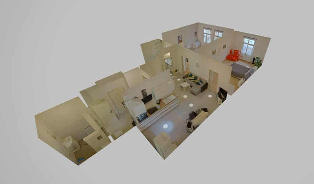
360 degree images and tours allow builders, architects and prospective real estate buyers to take a photo-realistic tour of the construction site or property from a distance.
Inspection flight

The inspection of industrial plants, structures and other hard-to-reach places can be carried out by drones in a more cost-effective, risk-minimising and flexible way.
Mobile Internet

With our emergency internet (mobile LTE and satellite units), we can bridge network failures at companies or facilities for several hours or even days.

For 10 years, the RBM Documentation Service has been working on projects around the globe

Wir erstellen 360 Grad Touren durch Gebäude, Apartments, Bauwerke und mehr. Immobilien- & Wohnungsbesichtigungen ganz einfach digital am PC oder Smartphone. Mit 3D Modellen und Grundrissen oder Lageplänen. Virtuelle Rundgänge durchs Möbelhaus mit anklickbaren Hotspots zu Bestell- & Infowebseiten. Oder das eigene Restaurant mit mehr als nur Fotos präsentieren.
#360grad #photosphere #virtualreality #vr #photography #360camera #foto #photo #virtuelletour #tour #rundgang #digital #immobilienmakler #immobilienverkauf #wohnungsbesichtigung #bauwerk #burgruine #smallplanet
#creativephotography #spherical #panorama #theta #ricotheta #virtualrealityexperience #virtualtour
#hotspot #elearning #rom #dokumentationsdienst
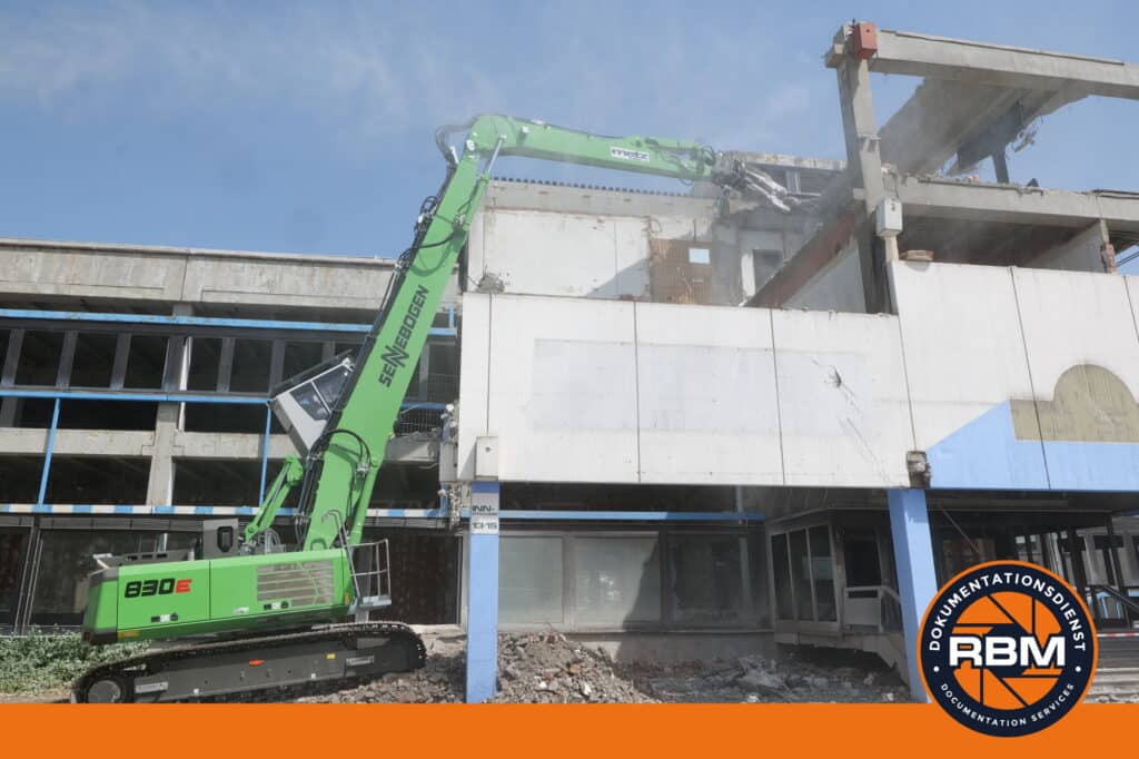
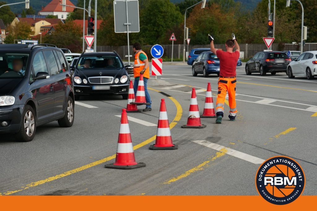
Baustellendokumentation & optische Beweissicherung - Stadt, Land, Bahn, Autobahn - im Hoch-, Tief- & Ingenieurbau #baustelle #baumaschinen #spezialtiefbau #tiefbau #hochbau #ingenieurbau #bauwerk #brücke #tunnel #erdbau #autobahn #construction #beweissicherung #dokumentation #foto #baudokumentation #baustellendokumentation #bahn #bahnbau #dokumentationsdienst #bayern #straßenbau #verkehrswegebau
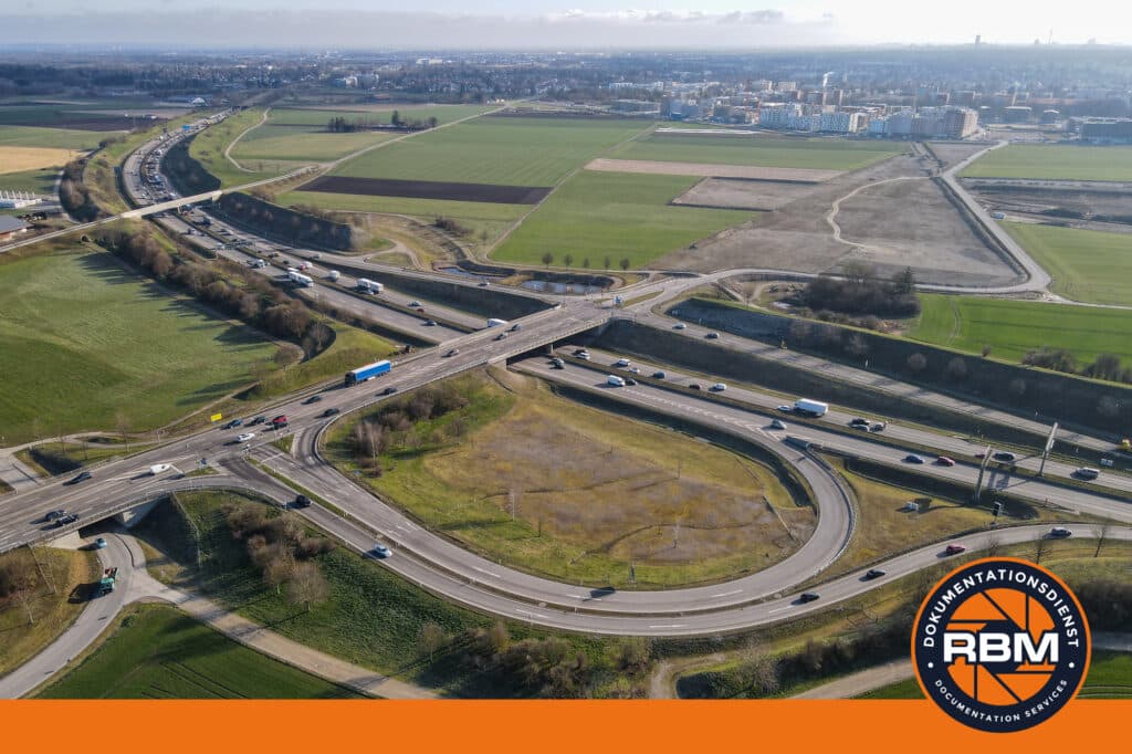
Luftaufnahmen per Drohne - Tag & Nacht. #luftbild #aerialphotography #drohne #drone #dronephotography #luftbildfotografie #baustelle #baumaschinen #dokumentation #foto #video #rbm #dokumentationsdienst #tiefbau #hochbau #abbruch #infrastructure #verkehrswegebau #ingenieurbau #straßenverkehr #straßenbau #tunnel
Wir bieten Zeitrafferkameras an und produzieren auf Wunsch auch Timelapse-Videos. Für kleine und große Projekte. #timelapse #zeitraffer #video #webcams #baustelle #verkehrswegebau #tiefbau #hochbau #ingenieurbau #abbruch #baumaschinen #dokumentation #zeitraffervideo #timelapses #construction
RBM Dokumentationsdienst: Professionelle Foto- und Videodokumentation für höchste Ansprüche
In der heutigen Zeit, in der Qualitätssicherung, Beweissicherung und Dokumentation immer wichtiger werden, ist es entscheidend, auf professionelle Dienstleister zurückzugreifen. Der RBM Dokumentationsdienst hat sich genau auf diese Bereiche spezialisiert und bietet maßgeschneiderte Lösungen für Unternehmen, Behörden und Privatpersonen an.
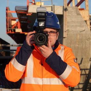
Unsere Arbeit zeichnet sich durch den Einsatz modernster Technologien aus. Neben hochauflösenden Foto- und Videokameras setzen wir auch Drohnen, 360 Grad Kameras und Anwendungen für 3D-Scanning ein. Diese Vielfalt an Ausrüstung ermöglicht es uns, für jede Anforderung die passende Lösung zu bieten.
Die Verwendung von 360 Grad Kameras ermöglicht es uns, Immobilien oder Schadensstellen mit einer beeindruckenden Detailgenauigkeit zu erfassen. Diese Technologie erlaubt es uns, im Nachgang einen virtuellen Rundgang durch das Objekt zu erstellen. So können sich Kunden und Interessenten ein realitätsnahes Bild von dem jeweiligen Objekt machen, ohne vor Ort sein zu müssen.
Mit Hilfe von Ground Control Points (GCP) können wir größere Flächen schnell und zentimetergenau vermessen. Das Ergebnis ist ein georeferenziertes Luftbild, das nicht nur beeindruckend aussieht, sondern auch höchste Präzision garantiert.
Aber nicht nur im privaten Bereich sind unsere Dienstleistungen gefragt. Im öffentlichen Sektor bieten wir ebenfalls innovative Lösungen an. Unsere Zeitrafferkameras sind ideal für Baustellen, um den Fortschritt der Arbeiten über einen längeren Zeitraum zu dokumentieren. Zudem stellen wir autarke Webcams zur Verfügung, die beispielsweise zum Verkehrsmanagement eingesetzt werden können.
Der RBM Dokumentationsdienst steht für professionelle Foto- und Videodokumentationen, die höchsten Ansprüchen gerecht werden. Mit modernster Technik, wie Drohnen, 360 Grad Kameras und 3D Scanning, sowie speziellen Techniken wie den Ground Control Points, bieten wir unseren Kunden maßgeschneiderte Lösungen für jede Anforderung. Ob Qualitätssicherung, Dokumentation oder Beweissicherung – mit uns haben Sie einen zuverlässigen Partner an Ihrer Seite.


Projects

Dokumentation Einsatzübung Zugunfall, Neutraubling
Folgendes Szenario spielte sich kürzlich auf dem Bahnübergang der Südumgehung in Neutraubling ab, als etwa 400 Rettungskräfte zusammenkamen, um eine Übung zur Bewältigung eines Massenanfalls von Verletzten (MANV) durchzuführen: Ein…

Notfallübung Tunnel Pfaffenstein
Im März 2024 wurde ein Test der Notfalleinrichtungen im Tunnel Pfaffenstein durchgeführt. Hierbei wurde die Lautsprecheranlage sowohl innerhalb des Tunnels als auch vor dem Tunnel geprüft. Im Falle eines Brandes…
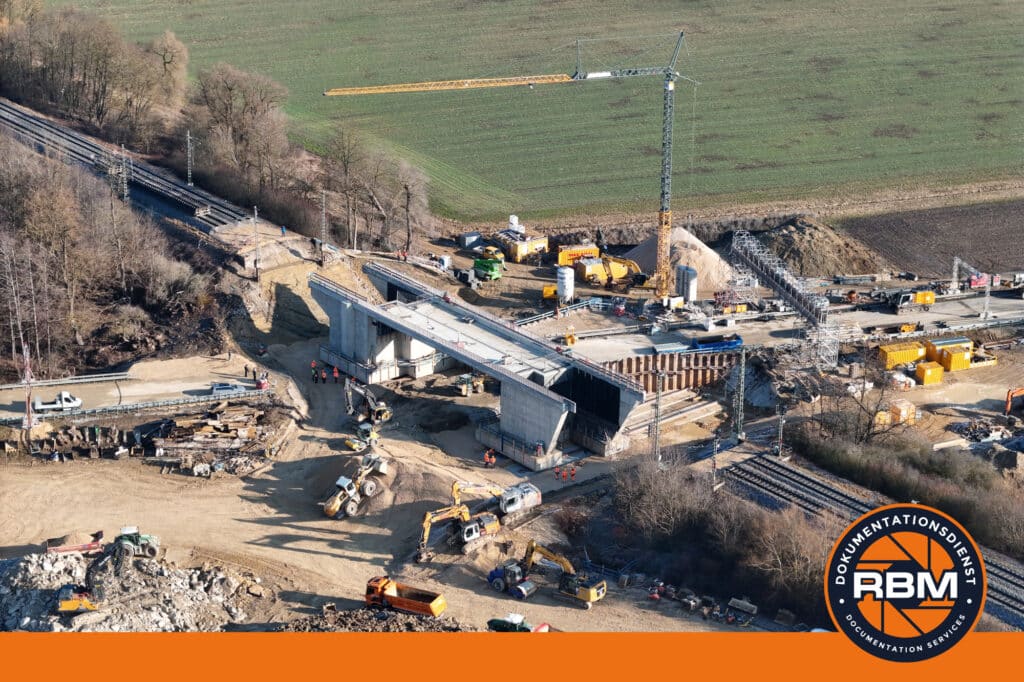
Neubau Eisenbahnüberführung (EÜ) Donauwörth, B25
Im Rahmen eines umfassenden Infrastrukturprojekts setzt die Deutsche Bahn ihre Bemühungen fort, die Eisenbahnüberführung aus dem Jahr 1931 über die Bundesstraße 25 zu erneuern. Diese wichtige Verkehrsader, die zuletzt im…
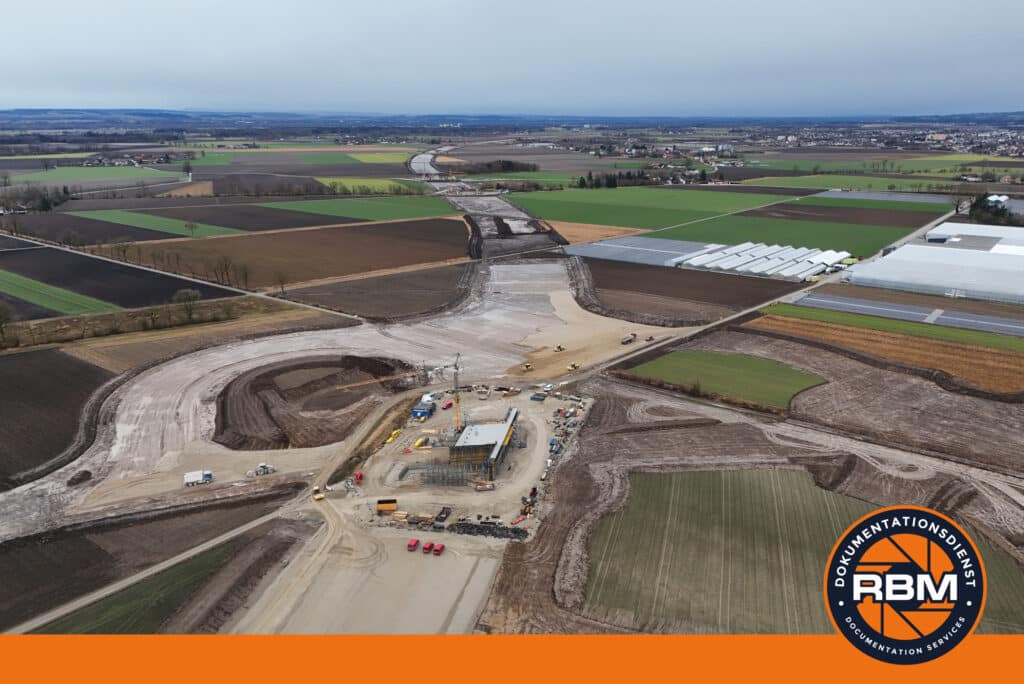
4-streifiger Neubau BAB A 94 Kirchham-Pocking
Die Fortschritte beim Bau der Autobahn A 94 zwischen Kirchham und Pocking zeigen, dass das lang ersehnte Projekt weiter voranschreitet. Ein Blick auf die jüngsten Entwicklungen verdeutlicht den Einsatz und…

Bau einer Geh- & Radwegbrücke über die Donau
Die feierliche Eröffnung der lang ersehnten Geh- und Radwegbrücke bei Sinzing über die Donau am 20. Dezember 2023 markiert einen historischen Moment für die Region um Regensburg. Dieses eindrucksvolle Bauwerk,…
Neubauabschnitt Malching-Kirchham, BAB A 94
Der neue Abschnitt der A 94 zwischen Malching und Kirchham ist ein wichtiger Meilenstein in der Entwicklung der Verkehrsinfrastruktur in der Region. Die Fertigstellung dieses Straßenabschnitts bringt eine Vielzahl von…
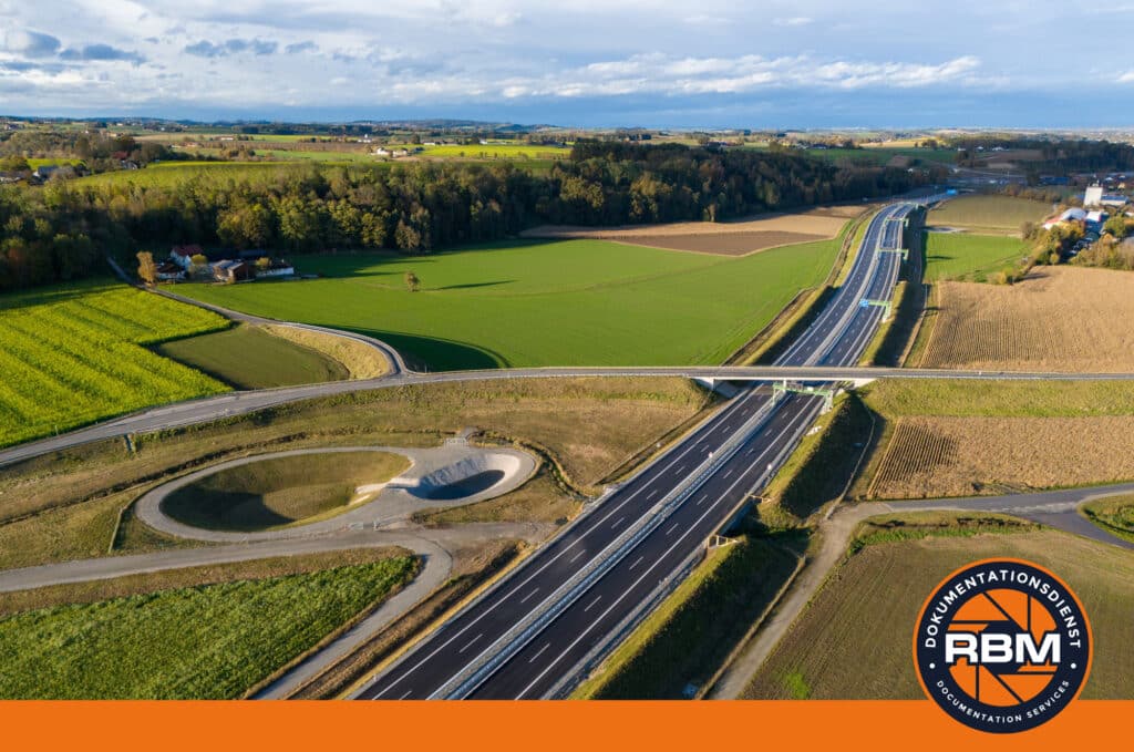
Tunnel Tutting A 94
Der Tunnel Tutting, Teil der Autobahn A94, ist ein bedeutender Verkehrstunnel in der Region. Mit seiner Lage zwischen den Städten Passau und München spielt er eine wichtige Rolle im regionalen…

Notfallübung Kreiskrankenhaus Wörth a. d. Donau
Im September 2023 führte das Kreiskrankenhaus Wörth an der Donau eine Notfallübung zum Thema Brand und Evakuierung durch. Die Übung wurde in Zusammenarbeit mit den örtlichen Feuerwehren und dem Rettungsdienst…
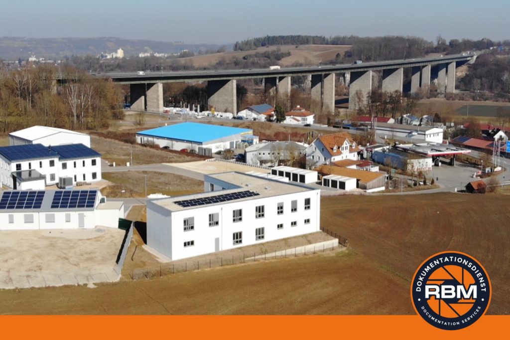
Neubau Produktionshallen
Eine Firma im westlichen Landkreis von Regensburg, die auf die Herstellung von Automatisierungstechnik spezialisiert ist, hat kürzlich einen bedeutenden Meilenstein erreicht. Zwischen Juni 2023 und Dezember 2023 wurden zwei brandneue…

Fahrbahnerneuerung BAB A 9
Der Flüsterasphalt, auch bekannt als offenporiger Asphalt, auf der A 9 zwischen dem Autobahnkreuz Neufahrn und dem Autobahnkreuz München-Nord hatte sein Lebensende erreicht. Die vermehrten Fahrbahnschäden, insbesondere in den Wintermonaten,…

Fahrbahnerneuerung A 93 FR Holledau
Der Streckenabschnitt der A 93 zwischen der Anschlussstelle Regensburg-Süd und dem Dreieck Saalhaupt erstreckt sich über eine Länge von etwa 11 Kilometern und wurde im Jahr 1984 für den Verkehr…

Dokumentation TraumaTag für Schulungszwecke
Der TraumaTag 2023, organisiert vom Zweckverband für Rettungsdienst und Feuerwehralarmierung Regensburg (ZRF) unter der Leitung des Ärztlichen Leiters Rettungsdienst, Dr. Markus Werkmann, in Zusammenarbeit mit der Staatlichen Feuerwehrschule Regensburg (SFSR),…

Dokumentation Einsatzübung Dom, Regensburg
An einem Samstag im April 2023 fand im Regensburger Dom St. Peter eine groß angelegte Brandschutzübung statt, bei der verschiedene Szenarien simuliert wurden, um die Einsatzbereitschaft und das Zusammenspiel der…
Rück- & Umbau eines Geschäftsgebäudes zu einem Autohaus
Im nördlichen Teil der Stadt Regensburg erlebt derzeit ein Geschäftsgebäude eine bemerkenswerte Metamorphose: Es wird in ein modernes Autohaus umgewandelt. Dieses ehrgeizige Projekt hat bereits bedeutende Fortschritte gemacht, wobei Teile…
BAB A 99 – München West
Der geplante sechsspurige Ausbau der A 99 im Westen soll voraussichtlich im Jahr 2028 beginnen, wobei ein drei Kilometer langer Abschnitt zwischen dem Autobahnkreuz München Süd-West und dem Südportal des…

Securing the embankment of the A 93
In the early 1980s, the concrete carriageway along the A 93 was opened to traffic. In the meantime, the carriageway has reached the scheduled end of its service life and must therefore be gradually...

Video documentation Tunnel Oberau
At the end of May 2022, the 4.2-kilometre-long Oberau bypass (B 2neu) was opened to traffic. Its centrepiece is the newly constructed road tunnel almost 3 kilometres long - the tunnel...

New construction of motorway junction A 3 / A 94
Building an motorway from Munich to the east is not a new idea. There was already this consideration in the 1920s. Then, in 1971, a four-lane connection was...

Expansion of the A 3 near Regensburg
Since 2018, the A 3 in the Regensburg area has been widened from two to three lanes in each direction. The section in the eastern construction phase was already opened to traffic last year....
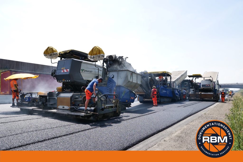
Installation of porous asphalt (OPA)
We created the following photo and video documentation for the Autobahn GmbH des Bundes Southern Bavaria branch: Over two weekends, we carried out the installation of the final noise protection pavement (porous asphalt; OPA) on the...

Test release height control
In April 2021, the height control at structure 28 - Prüfening Tunnel - on the BAB 93 was activated. Prior to this, there was a test run with representatives of the responsible road traffic authority, the traffic...
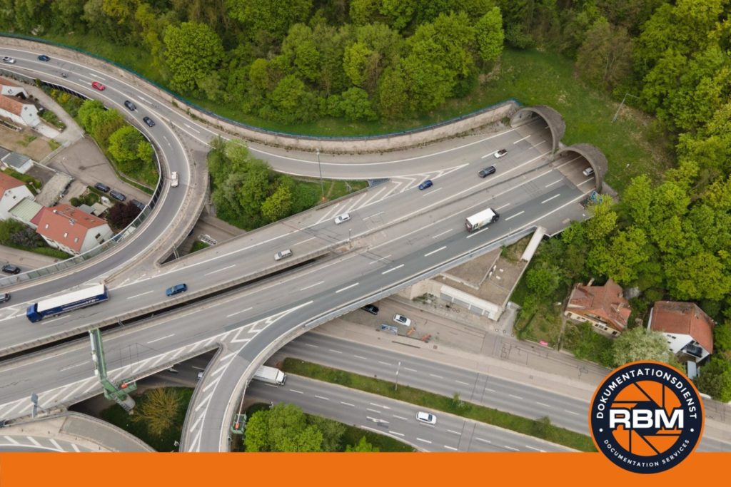
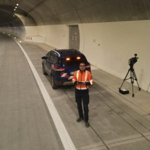
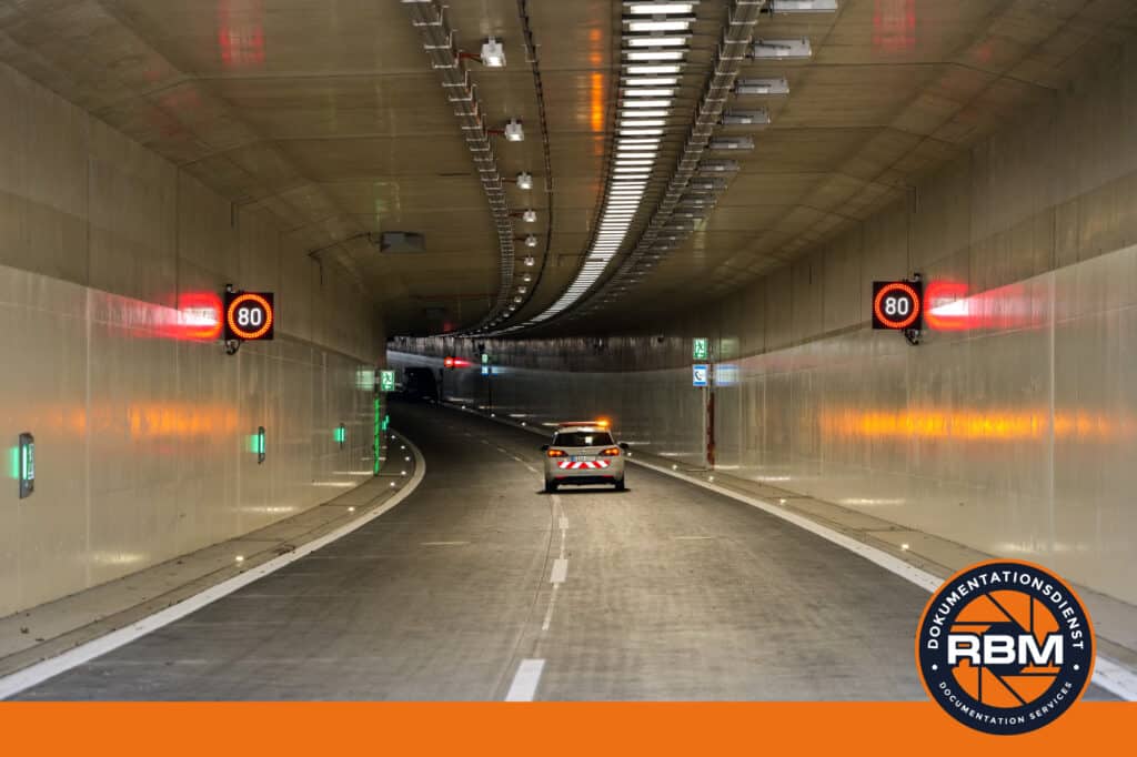
Picture documentation Pfaffenstein Tunnel
The Pfaffenstein tunnel is a two-tube road tunnel with two lanes in each direction. The tunnel crosses the Winzerer Heights over a length of 880 metres between the Regensburg-Nord and...

Exploratory drilling Tunnelling
The RBM documentation service has produced the following photo documentation in the field of tunnel construction: On the Winzerer Höhen near Regensburg, the Autobahn GmbH des Bundes Southern Bavaria Branch is carrying out exploratory drilling above the Pfaffenstein motorway tunnel....

Dismantling temporary bridge
We created a photo documentation and a time-lapse for the Southern Bavarian Motorway Directorate on the dismantling work of a temporary bridge. The temporary bridge spanned the BAB 3 between the Neutraubling and Rosenhof junctions. Under...
Traffic opening of local transport bridge
On 09.10.2020 at around 1 pm, the bridge on Walhallastraße was opened to traffic. It leads over the A3 motorway and connects the towns of Barbing and Neutraubling, as well as directing the...

Bridge construction using the incremental launching method
For the former Autobahndirektion Südbayern (now Autobahn GmbH des Bundes Niederlassung Südbayern) and the company Lots* Gesellschaft für verändernde Kommunikation mbH, we designed the bridge construction site on the A3 in Regensburg-Burgweinting,...
New office building
Raiffeisenbank Sinzing eG built a new office building for rent and lease in 2017/2018. A multifunctional building is being constructed on the 1,500 square metre site. On the ground floor, 600 square metres of storage space...
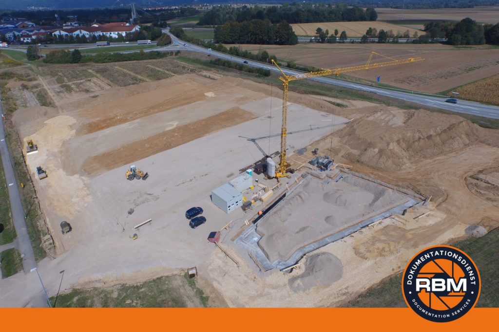
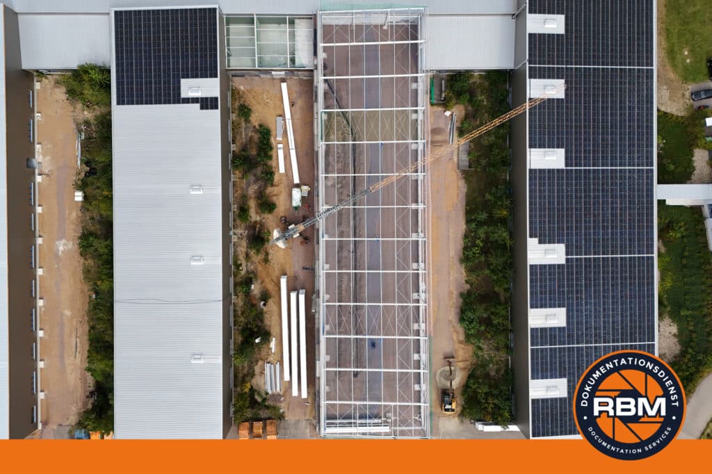
New construction industrial building
In 2015/2016, AyTec Automation GmbH built a new industrial building near Rosenhof in the district of Regensburg. Two production halls and an administration building were built on the 40,000 square metre site. We have...